The Spatial Browser Model
Introduction
This section provides a high-level overview of how the Spatial Browser functions. It covers the following topics:
Spatial Map Meta Model
Spatial Super Type
SpatialSuperType is an abstract EVA Netmodeler type which serves as a super type for types which should be treated as spatial, i.e. appear in the spatial browser.

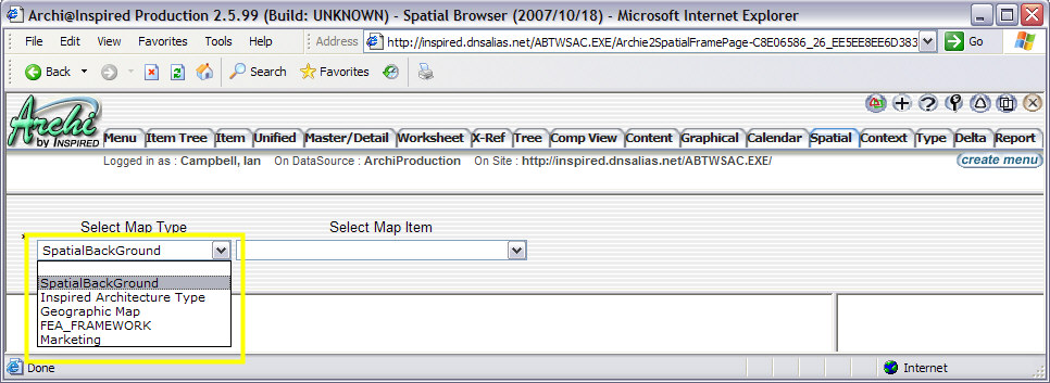
Map Types
Map Type can be any type that has a "is a" relationship to SpatialSuperType.
SpatialBackGround is an example of a Map Type which is packaged with EVA Netmodeler. You can use this type definition by simply creating new items of this type, or you can clone and extend it to create your own Map Type.
You can also extend any other Type in the repository to become a Map Type by extending its definition to include:
- the "is a" relationship to SpatialSuperType
- the following properties
Attribute name
|
Usage
|
PICTURE
|
The background picture
|
PICTURE WIDTH
|
Only used if the value > 0
|
PICTURE HEIGHT
|
Only used if the value > 0
|
BACKGROUND ITEM TYPE
|
The nodetype description of the background item, which will be used to filter other items by
|
BACKGROUND ITEM
|
The name of the instance to be pre-selected as a focus instance when this map is rendered.
|
SHOW DROPDOWN
|
If the value of this attribute is 'Y', a drop-down box will be displayed at the top of the screen, and the user may select any item in this drop-down. If the value is not 'Y', the
dropdown will still be there, but it will be hidden, therefore the user will be unable to select a different item from the dropdown.
|
This should only be necessary if you have a Note Type with its own unique properties and relationships and you want to
extend it to also become a map type. The list of available Map Types are displayed in the Map Type selection drop-down list on the Spatial Browser, and any new map type that you create will be added to this list.


Map Items
Map Item can be any type that has "belongs to" legal relationship defined to any Map Type. Items of these types appear on a spatial map in the spatial browser.
Spatial Item is an example of a Map Item type which is packaged with EVA Netmodeler. You can use this type definition
by simply creating new items of this type, or you can clone and extend it to create your own Map Item type. You can also extend any other Type in the repository to become a Map Item type by extending its definition to include:
- the "belongs to" relationship to any type defined as a Map Type as described above
- the Spatial Item properties
XPOS
|
The horizontal position of the Item
|
YPOS
|
The vertical position of them Item
|
PICTURE NAME
|
The picture to be displayed, if not present the NodeType image is displayed
|
PICTURE WIDTH
|
Only used if > 0
|
PICTURE HEIGHT
|
Only used if > 0
|
SHOW DESCRIPTION
|
If 'Y', the instance name is displayed as text below the picture.
|
PICTURE TOOLTIP
|
If there is a value in this attribute, the value is shown as the picture tooltip, otherwise the instance name is shown as a tooltip.
|
DEFINES ITEM TYPE
|
Determines the NodeType instance list to be displayed at the right of the map when the user clicks on this item.
If the "Filter List by Focus" and/or the "Via Rel Type" attributes have values, these will cause the resulting list of instances displayed to be filtered to those that are related
to the focus item of the background dropdown list.
|
DEFINES ITEM
|
When this value is provided, and there is no background item or the "Filter List by Focus" is set to "N", the details of this instance will be shown when the user clicks on the
item
|
Filter List By Focus
|
If 'Y', the list of results displayed will be filtered by their relationship to the selected background item.
|
Via Rel Type
|
This setting is used to refine the filtering of results to a specific RelType and NodeType between the item type specified by "Defines Item Type" attribute and the background focus instance.
This attribute is also used for "PATHS", which are documented in the next section.
|

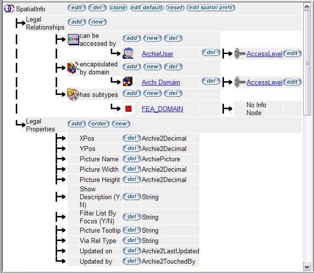
SpatialInfo
Spatial Info is an Info Node that records relationship information between a spatial background and a spatial item for the spatial browser. Typically location, size, representation.


Rendering a Spatial Map
When a user navigates to a particular map in the Spatial Browser, the following Attributes are used to build and render the background HTML:
Attribute names are converted to uppercase before comparison takes place.
Once the background HTML has been generated, the HTML for all items that must be displayed on top of the background item is generated.
These items are collected as follows:
- All target node instances associated with background item via relationship indicated by the 'MapInstanceRelType' setting.
- For each one of these target items, the following attributes are used to render HTML:
Attribute names are converted to uppercase before comparison takes place.
If there is an info node on the relationship between the Spatial Item and the Spatial Background, the info node attribute values will override the values of the Spatial Item attributes for the following list of attributes:
- XPOS
- YPOS
- PICTURE NAME
- PICTURE WIDTH
- PICTURE HEIGHT
- SHOW DESCRIPTION
- FILTER LIST BY FOCUS
- VIA REL TYPE

Paths
The situation may arise where it becomes desirable to display an instance list that is derived by following a specific navigation path, starting from the background focus instance.
The path may be of an arbitrary length. In order to cause the Spatial Browser to exhibit this type of behaviour, first
determine the ultimate NodeType you would like the user to arrive at, then enter this NodeType description into the "Defines Item Type" attribute.
Next determine the path that must be followed to arrive at the target NodeType from the background focus type.
For example, if the background focus type is "Project" and you want the system to navigate from "Project", to "Resource" via the "uses" RelType, then from "Resource" to "Assisted Process Step" via the "connects to" RelType.
Then you would change the value of "Defines Item Type" to "Assisted Process Step", and the value of "Via Rel Type" to: "PATH:uses-Resource;connects to-Assisted Process Step".

|